For a tropical cyclone to form and strengthen (called tropical cyclogenesis), several environmental conditions need to be present. The factors that determine whether there is tropical formation are the existence of an atmospheric disturbance, sea surface temperatures, moisture, wind shear, instability, and distance from the equator. I will talk about each of these factors and what level of each produces favorable conditions for tropical cyclones.
Pre-existing Tropical Disturbance
The most integral requirement for the development of a tropical cyclone is that there be an initial weak disturbance that has enough rotation and low-level convergence. An example of this would be a tropical or easterly wave. Tropical waves have low pressure and have an area of disorganized thunderstorms associated with them. The waves come off of northwest Africa and move into the Atlantic Ocean where they then can develop into a tropical cyclone. Most tropical storms and hurricanes start out as easterly waves, but just because there is a tropical wave does not mean a tropical cyclone will form. In fact, only about 20% of these waves develop into tropical cyclones. So there are clearly other factors at play in determining formation of storms. One of these is sea surface temperatures.
Sea Surface Temperatures
Sea surface temperatures (SST) are a big factor in tropical cyclone development because evaporation of seawater provides the energy that drives a tropical cyclone. SST have to be 26.5°C (80°F) or higher through a depth of the ocean of at least 50 meters (150 ft). The higher the SST, the greater the chance that a tropical cyclone will form or intensify.
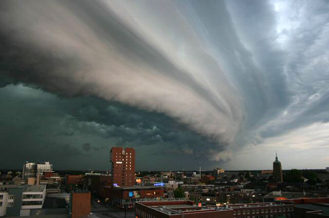
Tropospheric Moisture
There needs to be a sufficient amount of moisture in the troposphere so that condensation occurs and clouds and thunderstorms form. The value of relative humidity required for tropical cyclones is usually about 50-60% near the middle troposphere (approx. 5 km up). Dry air will kill the thunderstorms and prevent the development of a tropical cyclone.
Wind Shear
Vertical wind shear (change in wind speed and direction with height) has to be low (less than 20 knots) for tropical cyclogenesis to occur. If wind shear is too high, a tropical disturbance or cyclone will get ripped apart and the thunderstorms will be displaced from the circulation. Also, the shear can bring dry air into a storm which, as I noted already, is detrimental to the formation or strengthening of a tropical system.
Instability
The atmosphere has to be unstable for a tropical disturbance to develop or for a tropical cyclone to strengthen. Instability means that a parcel of air will rise due to it being less dense than the environment around it. This is related to tropical cyclones because they need the evaporated ocean water to rise until it condenses and forms clouds, precipitation, and thunderstorms. More instability means that thunderstorms will be more numerous and stronger which promotes cyclogenesis.
Coriolis Force
Finally, tropical disturbances must be at least 5° of latitude away from the equator to develop into cyclones. This is because of the Coriolis force which causes weather systems like tropical cyclones to rotate. The Coriolis force is zero at the equator and increases as you get closer to the poles. Tropical disturbances have to spin to be able to maintain their low pressure.
Summary
As you can see, there are several conditions that need to be present for cyclogenesis to occur. Even if all these conditions are met, that still does not mean that a tropical cyclone will form for sure. There is also likely a possibility that a tropical cyclone could form without a completely favorable environment. But the factors that I laid out are generally what is required for the formation and intensification of tropical cyclones. With all these factors determining whether cyclogenesis occurs, you can see how tropical cyclones can be very sensitive to changes in their environments. An example that I remember is Hurricane Irene of 2011, which was forecast at one time to strengthen to a Category 4 hurricane as it moved north just off the southeast U.S. coast. But dry air over the land got wrapped into Irene and weakened the storm to a Category 1 hurricane before it made landfall in North Carolina. This case shows how one unfavorable environmental factor can have a big impact on the intensity of a tropical cyclone.
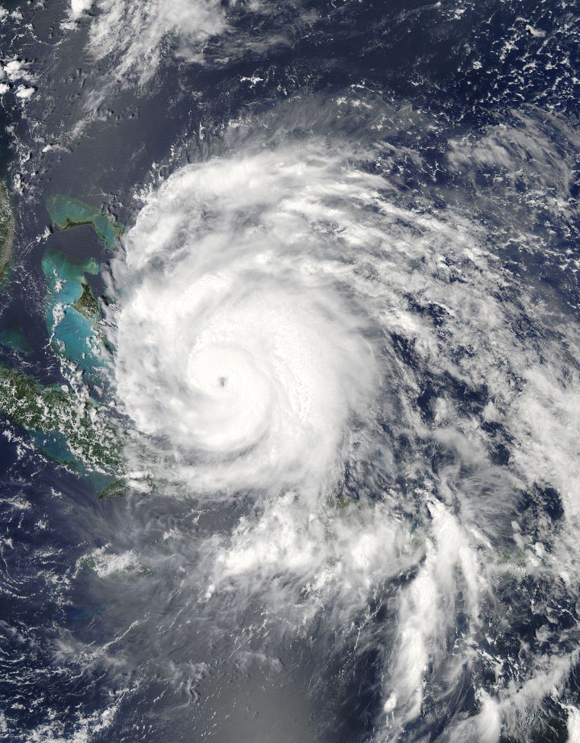 Category 3 Hurricane Irene. Image Credit: NASA and Wikipedia
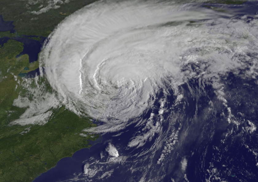 Tropical Storm Irene making landfall in New York City. Image credit: NASA and Wikipedia
Sources:
http://weather.about.com/od/t/g/tropical_wave.htm
https://en.wikipedia.org/wiki/Tropical_cyclogenesis#Requirements_for_tropical_cyclone_formation
http://www.usno.navy.mil/NOOC/nmfc-ph/RSS/jtwc/pubref/References/GUIDE/chap2/se302.htm
http://www.goes-r.gov/users/comet/tropical/textbook_2nd_edition/navmenu.php_tab_9_page_3.1.0.htm
http://www.aoml.noaa.gov/hrd/tcfaq/A15.html
http://www.theweatherprediction.com/severe/ingredients/instability/
https://en.wikipedia.org/wiki/Hurricane_Irene
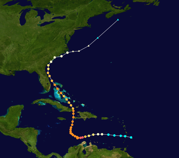
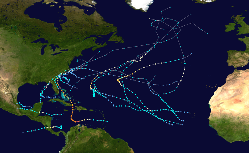 Tracks of all Atlantic tropical cyclones from 2016 with colored intensity dots (redder dots correspond to higher wind speeds). Image Credit: Wikipedia
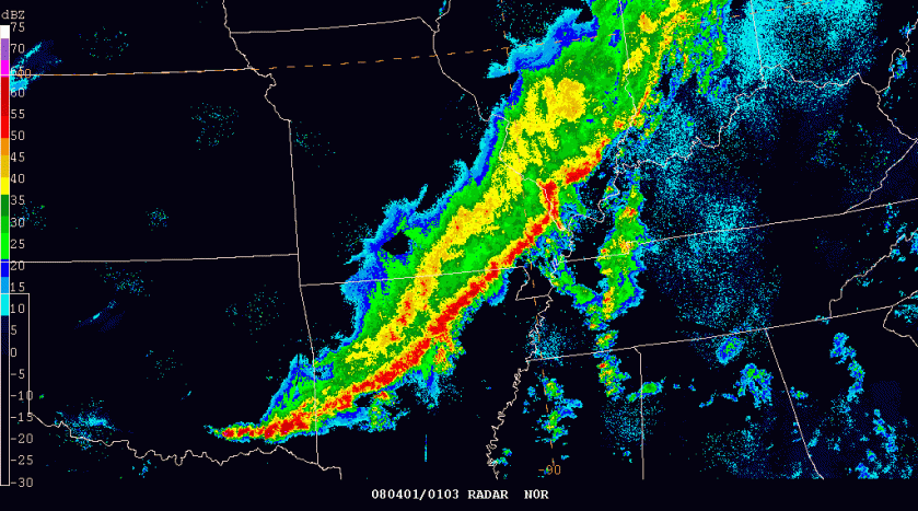 A radar image of a squall line. Image credit: Lyndon State College
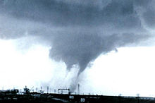
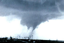
 A tornado in El Reno, Oklahoma that was generated by a supercell thunderstorm. Image credit: Wikipedia
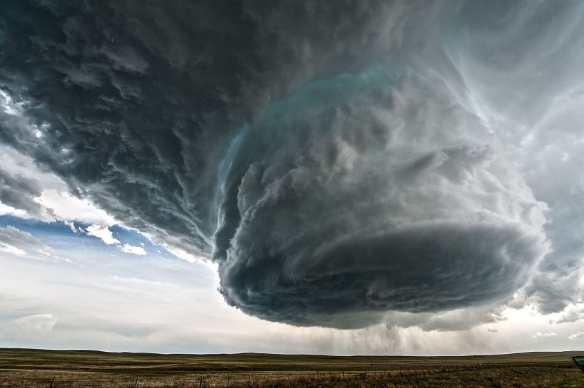
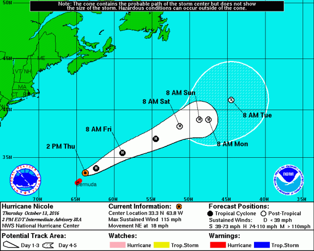 Hurricane Nicole Forecast Track Cone. Image Credit: NHC
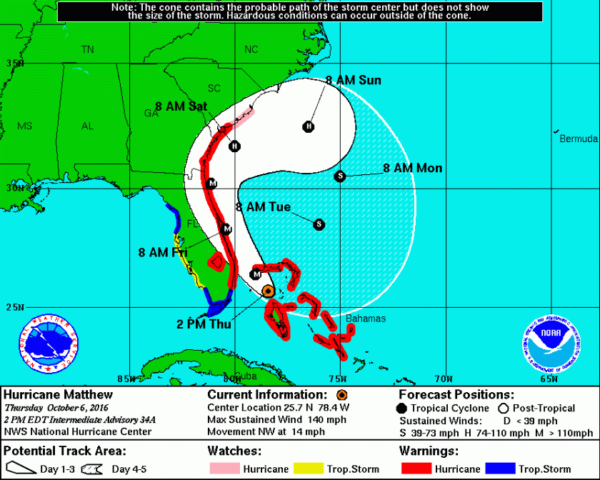 Hurricane Matthew Forecast Track Cone. Image Credit: NHC
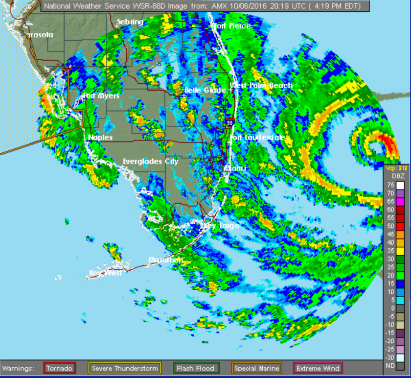 Radar image of Hurricane Matthew moving towards Florida. Image Credit: NWS
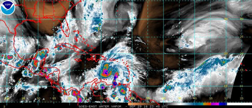 Water vapor image of the Atlantic Ocean with Hurricane Matthew located north of Venezuela in the eastern Caribbean Sea. Image Credit: National Hurricane Center
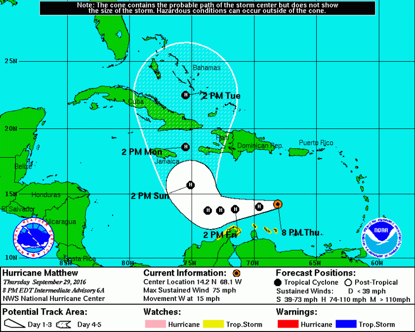 Forecast Track Cone for Hurricane Matthew. Image Credit: National Hurricane Center